Introduction
On October 6th of 2020, the AT 309 class was invited to attend a field outing that the AT 319 (The course that is taken after AT 309) class was conducting. The main purpose of the mission was to survey a portion of Purdue's Wildlife Area. The field outing also gave the 309 students a better understanding of what is done during field outings and how to perform them (correctly). For the purpose of this mission, the primary UAV that was used was the DJI M600 and a Mavic 2 Pro was provided for the 309 students to use.
Once we unloaded all of the equipment, it was time to set up the field. A miniature helipad was laid out for the M600 to take off and land on. Figure 1 shows the M600 placed on the helipad.
Figure 1: This is the M600 about to take off for the mission.
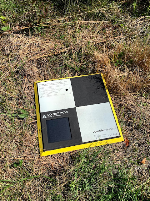
We also laid out ground control points (GCPs) to increase the accuracy of the GPS and coordinate systems relating to UAS. Figure 1 shows the Propeller Aeropoints GCPs.
Figure 2: This is one of the GCPs in the field.
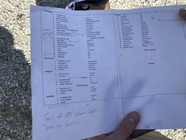
After the equipment was placed, the 319 students went through a predetermined checklist to ensure that everything was set up correctly and was going according to plan. Figure 3 shows the checklist.
Figure 3: This is the checklist that was used for the field outing mission.
After the unpacking, pre-flight, and takeoff checklists were thoroughly looked over and gone over, it was time to fly. Below is a video that was taken of the M600 taking off.
After takeoff, it was determined that the wind gusts at the time exceed the M600's capabilities, and the mission would have to be cut short for safety precautions since they were above eight meters per second. As for the Mavic 2 Pro, the sleek design of it allowed for it to be used during those conditions. The Mavic 2 was then used to give the 309 students a feel for using it out in the field and was not used for long. Below some of the steps taken are explained further in the discussion section.
Discussion
To better explain the decisions and processes of the field outing, we will dive a little bit deeper into all of it. The main purpose of using the M600 was due to its ability to hold a larger payload. The payload that was installed on the UAV was a sensor (Was not specified when in the field). The helipad it was placed on was for visual reference when surveying and marking an area for safe landing and take off.
The GCPs help to give data relations to the geographical world. When placing them down, they give off GPS and elevation related information. The Aeropoints use a cloud computing software to relay the information into a report for crew members to use.
The main purpose of the checklist is to give crewmembers a list of items to do at different stages of the mission and an idea of what is needed for safe operation. They also ensure that everything is going according to plan.
The main reason for canceling the outing, as mentioned, was due to wind gusts being above the M600's capabilities of eight meters per second. It was to ensure safe operation and that none of the crewmembers would be in danger. It also ensures that the M600 will not be damaged and that none of it is trashed.
Conclusion
The main purpose of this outing was to survey the Purdue Wildlife Area and to give the 309 students an idea of what they are like. This was very insightful and helpful to know what they are like. Beforehand, I have not personally been to one and was not really sure what they are like. Although we did not get to do an actual one, it was nice to see what it is like before take-off and data collecting. It was also informative because Professor Hupy let us know what is happening and helped to answer any questions that arose.


Comments
Post a Comment